Southern Brooklyn Community Organizations Active in Disaster (Southern Brooklyn COAD) has released its Community Disaster Resource Maps! The maps are the result of a community organizing and resource surveying process facilitated by the NonProfit HelpDesk of the Jewish Community Council of Greater Coney Island and funded by the New York State Governor’s Office of Storm Recovery that has brought together 40 nonprofit, faith-based, and community-based organizations from Sea Gate, Coney Island, Brighton Beach, Manhattan Beach, Gravesend, and Bensonhurst to form the Southern Brooklyn COAD, a coalition working together to make sure that Southern Brooklyn is prepared for emergencies and disasters and that the region is best served and able to coordinate recovery after a disaster.
Our Community Disaster Resource Maps show the names, addresses, and phone numbers of the members of the Southern Brooklyn COAD (those with physical locations), as well as the basic service/resource they provide year-round, in order to inform the community as to which organizations are committed to working together before, during, and after disaster to help connect them to services, resources, and information. The COAD operates under a “No Wrong Door” policy, meaning that if any one organization is not able to help a particular individual, they will make a best faith effort to connect them to someone who can.
The maps were created in four formats:

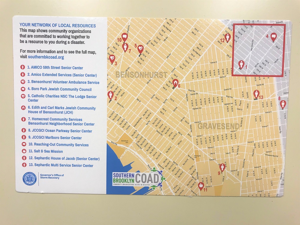
1. Regional Brochures/Folded Maps
The six neighborhoods the COAD represents were divided into three regions – Gravesend & Bensonhurst, Brighton Beach & Manhattan Beach, and Sea Gate & Coney Island – each of which has a unique brochure. Each has on one side a map all six neighborhoods and the locations of COAD member organizations; on the other side is a map focused on that specific region. Brochures are available in English, Chinese, Russian, and Spanish.
2. Refrigerator Magnets
Each regional map was also reproduced in a simplified, refrigerator magnet form. The magnets show COAD member locations and include a link to the COAD’s website where people can view the instantly updatable online map (see below).
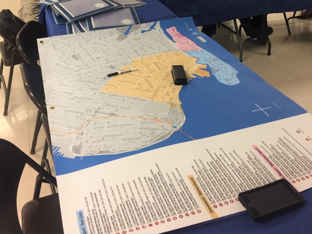
3. Large Format Map
The COAD also created a large 48″ x 33″ map of the area and member locations that COAD members can used to direct community members to the locations of available resources or for internal disaster response planning. These maps are laminated so that they can be written on and erased as conditions change.

4. Instantly Updatable Online Map
Finally, the same maps are available as an instantly updatable online map that lives on our newly launched website: www.southernbkcoad.org. You can find the online map by navigating to the “Resources” tab and selecting “Community Resource Map.” Before or after a disaster, it can be updated daily with resource locations (cooling center locations during a heatwave, reception centers after a building collapse, resource distribution points, etc.).
The Southern Brooklyn COAD has been steadily growing over the past several months and we are excited for what the future holds. Already we have started distributing brochures and magnets at resource fairs and events to curious residents who have found the maps to be a useful reference. If you represent an organization or group in Gravesend, Bensonhurst, Coney Island, Sea Gate, Brighton Beach, or Manhattan Beach and are planning a event that you think would benefit from the COAD being present at to distribute these items, or if your group would like your own copies to keep on hand, please email: southernbkcoad@gmail.com.